Why So Many People Once Believed That California Was Actually An Island
For those who've grown up in our instant-access Google Street View age, it can be hard to imagine that the world was once a place full of unknown locations. Landmasses weren't mapped, continents weren't explored, and lifeforms were mysterious and hidden in the far crevices of forests, caves, and seas. It wasn't too long ago that folks still used paper maps to get around places, pre-internet. Basic regional maps date back to the 6th century B.C.E., when cartography was a crucial method of denoting borders and trade routes. Lots of maps stand out through medieval times, like the 10th-century map from Ibn Hawqals based on his travels and the works of the Roman polymath, Ptolemy. But it wasn't until the 1500s that maps started to take on the shape of the world we know today.
Still, perfecting the details of coastlines took hundreds of years. Better maps developed lockstep with the European Age of Discovery from around the mid-1400s to late-1600s. Portuguese sailors used the Earth's oceans to explore, followed by the Dutch, Spanish, English, French, and more. But even so, the most difficult places to reach — like Antarctica — have only been fully mapped thanks to satellite imagery.
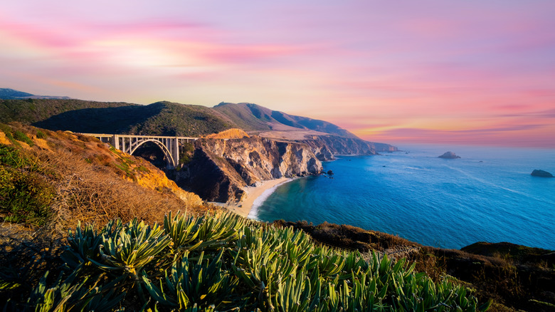
As hard as it might be hard to imagine, even a place as modernly well-known as California remained imprecisely mapped. Bordered by the Pacific Ocean on one side, the current-day United States on the other, and reachable by sea via sailing around the tip of South America, maps as late as 1650 and beyond depict it not as it looks, but as an island.
Early Spanish explorations of the Baja Peninsula
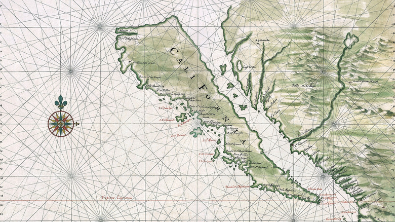
Looking at a 1650 map by Dutch cartographer Johannes Vingboons that depicts California as an island (shown above), one thing ought to stand out: The maps shows the modern-day Baja Peninsula in Mexico south of California, not what we currently call "California." It's also not exactly clear, based on the map, how much of the peninsula is actually depicted. The map becomes extra curious because 1538's famous Mercator Map from over 100 years prior shows the Baja Peninsula as a peninsula, not an island. So what's going on, here?
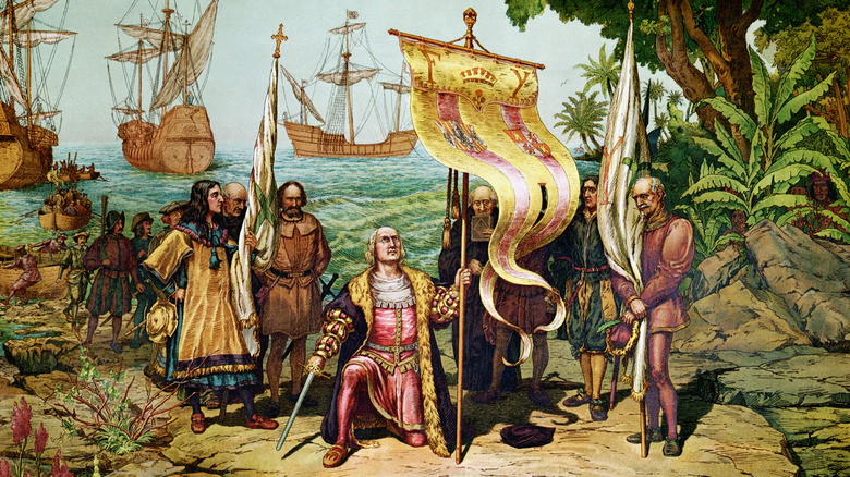
First off, the Spanish indeed confirmed by 1539 that Baja is a peninsula that connects to a larger landmass. They'd reached the Caribbean and Central American isthmus — the narrow bit of land from southern Mexico down through Panama — by 1501. By 1519, the well-known Spanish conquistador Hernan Cortes landed on the Yucatan Peninsula at Mexico's eastern tip. Fast forward 500 years and most countries from Mexico south speak Spanish.
Cortes made it out to the Baja Peninsula by 1535, two years after Spanish ships first reached it in 1533. Then in 1539, Cortes ordered Spanish explorer Francisco de Ulloa to map out the route up Mexico's western coast. De Ulloa's went from modern-day Acapulco all the way up into the armpit of the Gulf of California, south around the Baja tip, and then north to about Isla de Cedros on the peninsula's western coast. But despite his travels, some maps continued to depict "California" — i.e., the Baja Peninsula — as an island.
California: Setting for a fantasy adventure novel

Fictional characters, legends, and tales can not only influence or confirm beliefs, but outright create them. Enter the story of Queen Calafia who ruled a mythical, mystical, far-flung land full of Black, Amazon-style female warriors with "vigorous bodies and strong and ardent hearts," per Floating Homes. Queen Califia's land, California, featured front and center in the popular 1510 chivalric adventure book, "Las Sergas de Esplandián" ("The Adventures of Esplandián") by Spanish author, Garci Rodríguez de Montalvo. Montalvo most likely based on the name on the Arabic, "caliph."
It's a little hard to find a precise throughline linking "Las Sergas de Esplandián" to incorrect maps of the Baja Peninsula, although sources like IFL Science suggest as much. In Montalvo's story, Queen Califia's California was located "to the right hand of the Indies," (per Floating Homes), where "the Indies" ranged from India through southeast Asian islands like Indonesia. In other words, Europeans didn't realize how big the Pacific Ocean is (it covers more than 30% of Earth's surface).
The New York Times says that Spanish explorers were hoping to find the dreamlike, paradisical island described in Montalvo's novel. But even so, we don't know who named the Baja Peninsula, "California." As the California State Legislature wrote in 2017, "All is known for certain is that someone, presumably a Spanish navigator, applied the name to the territory ... sometime before the year 1541." In this scenario, the dreamlike visions of an island paradise called California stuck in subsequent mapmaker's minds more than reality. Island, not peninsula.
Mapmaking errors and misheld beliefs
Following early Spanish exploration of the Baja Peninsula and its naming of "California" by 1541, it seems like everyone understood that California was a peninsula, not an island. We mentioned that Gerardus Mercator's 1538 world map showed it as a peninsula. Abraham Ortelius's impressive 1570 world map, Theatrum orbis terrarum, showed the same. So did Cornelis van Wytfliet's 1597 map.
But come 1602 to 1603, Stanford University reports that expeditionary Antonia de la Ascensión wrote, "the whole Kingdom of California discovered on this voyage, is the largest island known." Historian Antonia Vázquez de Espinosa repeated the same in 1615 when he wrote, "California is an island, and not continental, as it is represented on the maps made by the cosmographers." In 1622, English mathematician similarly wrote, "California sometymes supposed to be part of ye westerne continent but since by a Spanish Charte taken by ye Hollanders it is found to be a goodly islande." By all accounts, this misinformation got repeated again and again, and made its way into maps like those of Johannes Vingboons in 1650 that showed California as an island. How Garci Rodríguez de Montalvo's 1510 novel, "Las Sergas de Esplandián," influenced this doggedly false view of California is unclear.
As Stanford Magazine reports, it took all the way until 1747 for the Spanish king, King Ferdinand VI, to intervene directly and issue an official royal decree stating directly, "California is not an island." But from 1622 until then, Stanford University has records of over 800 incorrect maps depicting California as an island.