Places That Were Abandoned After Horrifying Disasters
When disaster strikes, be it human-caused or natural, people often band together to rebuild the shattered world they once called home. In the immediate aftermath of Hurricane Helene, perhaps one of the most devastating hurricanes in history, charitable organizations like Samaritan's Purse sent countless volunteers and tremendous resources to those affected by the storm. They provided an escape from the dangerous environment and supplies to those who stayed in their homes, while also working to rebuild homes, clear roads, and remove debris. These efforts made huge strides in keeping the people of places like Asheville, North Carolina, in their community, but what happens when the damage is so great that there's no choice but to flee?
Cities, towns, and pillars of industry become abandoned for many reasons, but they rarely stay that way. Loads of towns in the American Old West fell prey to weather events or violence and quickly fell apart. Someone usually cleared away the rubble and built something new, but some disasters leave a scar that can never heal. Some examples are still off limits, but there are plenty of examples that live on as historical sites. Whether the land is uninhabitable or historically important, there are several places that are still abandoned after horrific disasters.
Centralia, Pennsylvania
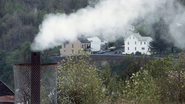
Centralia, Pennsylvania, sits roughly 90 minutes northwest of Billy Joel's beloved Allentown and fairly close to the center point of its home state. The burrough was once called Bull's Head after a tavern in the area, then Centreville in hopes that it could become an industrial nexus, but it became Centralia in 1866 when the founders realized there was already a Centreville, Pennsylvania. It was one of the nicer places for a coal miner in 19th-century America. Centralia existed as an anthracite coal mining town for most of the next century, even weathering the Great Depression without shutting down. In 1962, the city council set out to address issues with an abandoned mine that had previously been turned into a garbage dump. They set fire to the landfill, causing a blaze in an underground coal seam that would burn uninterrupted for the following decades.
The fire beneath Centralia spits smoke out of every available crack, cloaking the town in a thick, white cloud. The roads can reach temperatures above 900 degrees Fahrenheit, and sinkholes leading directly to pits full of fire are common. It's an active mine fire that could be fueled by any or all of the inactive mines beneath the abandoned city. In 1992, Pennsylvania condemned the city's buildings and eliminated the zip code, attempting to force its few inhabitants away from the burning city. As of the 2020 census, five residents still call Centralia home.
Wittenoom, Western Australia
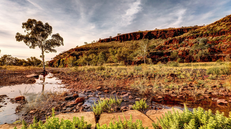
Wittenoom is like many mining towns in that it was gradually destroyed by the natural resource it was established to acquire and sell. Around 1915, a form of asbestos called crocidolite was discovered in the Hamersley Ranges of Pilbara in Western Australia. By 1925, miners rushed to monetize that material, only to lose their claims to a milling operation that was eventually bought out. From 1943 to 1966, a company called Colonial Sugar Refinery mined the blue asbestos en masse in the Wittenoom area, but it gradually became unprofitable, leading them to shut down the operation. Unfortunately, crocidolite is exceptionally dangerous, and the entire Wittenoom area was eventually condemned.
In 2007, the Western Australian government removed Wittenoom from the map to deter tourists from visiting. The surrounding area is full of asbestos tailings, a hazardous material that can cause mesothelioma in locals and visitors, marking the area as the largest contaminated site in the Southern Hemisphere. In 2022, parliament passed a bill that condemned the area and set to work demolishing the remaining buildings. They took no action to clean the remaining contaminants, leaving anyone nearby vulnerable to very aggressive cancer. This enraged the local Indigenous population, who urge the government to deal with the hazardous material and allow the local natives to resume tending to the land.
Picher, Oklahoma
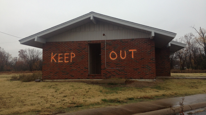
Picher, Oklahoma, sits on the northeast corner of the state, immediately adjacent to the border with Kansas and about 90 minutes from Springfield, Missouri. In the 1910s, those three states shared a lead and zinc mining district, leading to the 1918 establishment of Picher. Its population leapt from 9,700 to 14,000 over its first 10 years, but those numbers plummeted as mining profits declined over the following decades. Mining was at its height around the time of the First World War, resulting in tremendous amounts of lead and zinc byproduct, or chat, filling the town, one of many messed up things that happened during World War I. By the time mining shut down in the 1960s, all that lead had already made the town hazardous.
Plant and animal life started to die off as wastewater ran into the local creek in the late 1970s. While the EPA tried to address those issues, later studies revealed that undermining could result in countless cave-ins. This prompted the government to start buying out homeowners, allowing many to leave Picher behind. In 2008, an EF-4 tornado annihilated half of the town, expediting the buyout process and ensuring all but a handful of residents fled the area. One pharmacy owner remained in Picher until his death in 2015, but whether the elevated lead levels contributed to the unidentified disease that killed him at age 60 is unknown.
Villa Epecuén, Buenos Aires
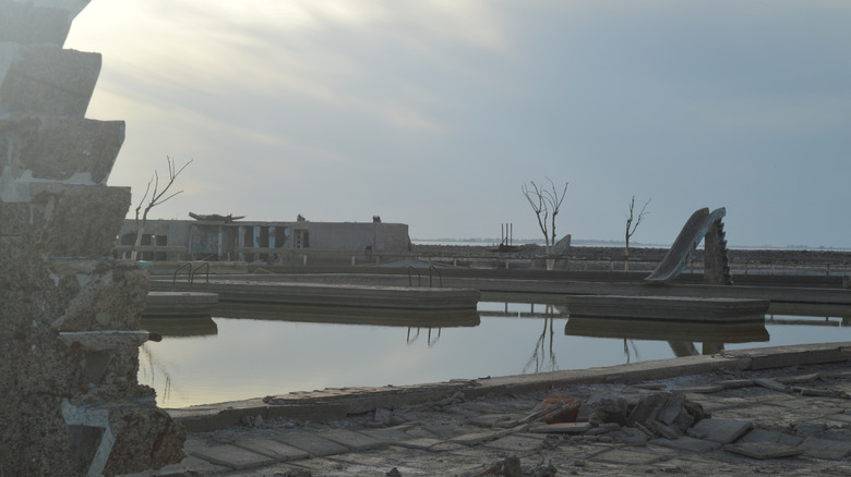
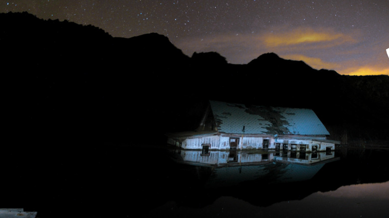
Villa Epecuén was established in 1921 as a tourist attraction in Argentina's beautiful Buenos Aires Province. Its main attraction was a natural salt lake called Lago Epecuén, which drove hundreds of thousands of visitors to make the trek in search of its purported healing properties. This supposed health tourism drove unprecedented growth to the area, eventually resulting in a town with 1,500 permanent residents, 5,000 available hotel beds, and as many as 25,000 tourists in its most popular summers. Unfortunately, on December 10, 1985, the very lake that built Villa Epecuén flooded and destroyed it.
A particularly rainy winter gradually overwhelmed the shoddy earthen dam that guarded Villa Epecuén, eventually drowning the resort town. This flood only increased in size over the years, growing deeper than 30 feet by 1993. Though it took over two decades, the waters eventually receded into the lake, unveiling the ruined structures. Villa Epecuén remained a tourist attraction during its underwater era as curious onlookers traveled to see the unique sights. After the waters cleared, a single former resident returned to the area and resumed living there. In 2024, he passed away, leaving Villa Epecuén empty once again.
Ani, Turkey
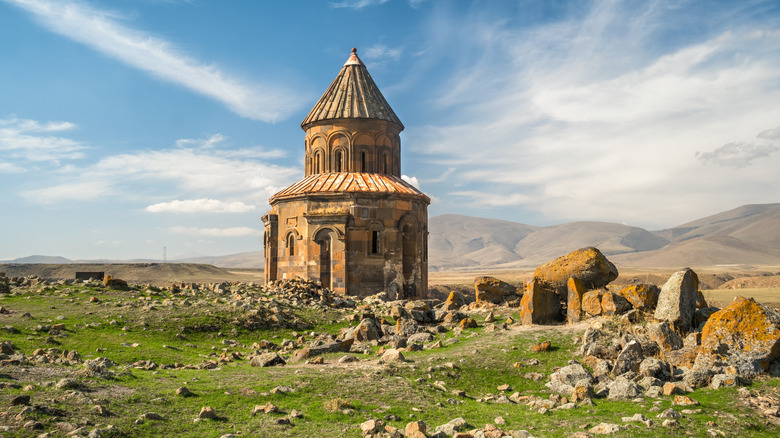
Ani was a medieval city that developed in the northeastern corner of Turkey, right on the border with Armenia, in the fifth century. It was located very close to a popular caravan route and a mighty river in the area, eventually prompting the Armenian king Ashot III the Merciful to make it his capital city. Beautiful churches with some of the finest architecture of the medieval era turned Ani into a truly gorgeous location. By the 11th century, as many as 100,000 people could have lived within Ani's walls, but the area fell to ruin over the next 200 years.
Mongol hordes laid waste to Ani throughout the 1200s, but the beautiful city suffered the far nastier wrath of nature when an earthquake leveled many of its structures in 1319. These disasters forced the capital into a period of sharp decline, and shifting trading routes eventually exacerbated those issues to the point of abandonment. The city was empty by the 18th century, but many elements of its artistic beauty still stand today. UNESCO recognizes Ani as an archaeological site that attracts tourists from around the world, allowing interested visitors to see what remains of the former capital.
Gilman, Colorado
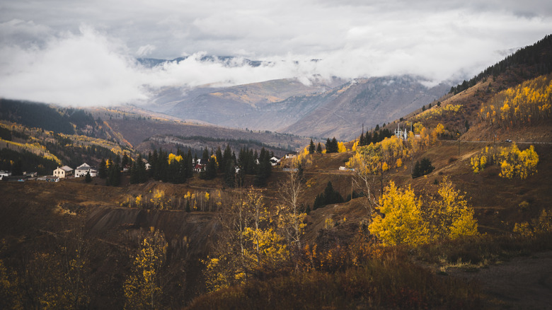
Gilman, Colorado, was once a mining town south of Vail and northeast of Aspen. The area immediately became mining territory after the great silver boom in 1879, quickly resulting in the establishment of Gilman a few years later. Only around 1,500 people lived in Gilman in its early years, but even those modest numbers had dwindled to around 400 within five years. Residents enjoyed the necessities of a town of the era, including multiple hotels, an opera house, and a local newspaper. A massive fire consumed many of those businesses in 1900, but even that didn't stop Gilman. Even as the small town continued to thrive, the effects of their main export caused danger to its populace.
Heavy metals contaminated the water, groundwater, and soil throughout the area over the decades of mining, wiping out much of the local ecosystem and forcing the government to take action. In 1986, the EPA declared Gilman part of the Eagle Mine Superfund Site and began work to clean up the area. The organization finished their work in 2000, but tourists are still not allowed to visit. Guides on the subject recommend driving nearby to view what's left of the once-great mining town, as the area remains inaccessible.
Chernobyl
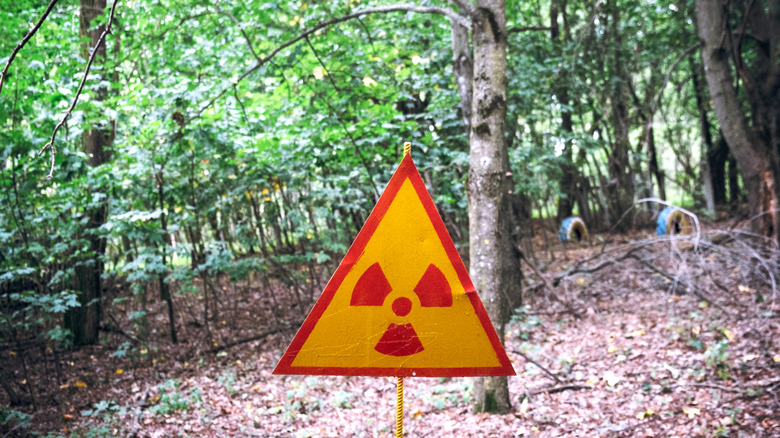
Ask a stranger to name an abandoned location, and they'll probably tell you what they remember about the Chernobyl Nuclear Power Plant and the nearby city of Pripyat in northern Ukraine. Before the meltdown, Pripyat was a relatively advanced Soviet city built to house and support nuclear power plant workers. On April 27, 1986, authorities began evacuating 115,000 citizens of Pripyat 36 hours after a series of explosions sent radiation spewing into the area. A grim Chernobyl cover-up followed. The 19-mile surrounding area remains uninhabitable decades later.
The Chernobyl exclusion zone is now a marshy, forested area full of abandoned property that has sat relatively free from human activity since its condemnation. It's against the law to live within the zone, though at least 100 people do maintain their land as subsistence farmers in the area. In the wake of the Russian invasion of Ukraine, a number of Ukrainian citizens took to living just outside of the border to avoid conflict and make use of the cheap real estate. One such resident, Maryna, told the BBC, "I don't care about the radiation. I only care that there are no shells flying over my children."
Craco, Italy
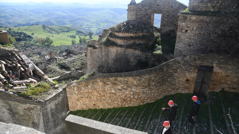
Craco is a medieval village that sits on top of a 1,300-foot cliff with an extremely steep summit in the Basilicata region of southern Italy. Sixth-century Greek monks were the first known inhabitants of the area, but Craco got its name from its 11th-century owner. Craco had a university, a very influential church, and a towering castle with a built-in prison, allowing its population to balloon to over 2,500. Craco suffered a plague in the 17th century and consistent attacks by brigands in the 19th century, but the medieval territory survived well into the 1900s.
A series of devastating landslides between 1959 and 1972 gradually annihilated many of the structures in Craco. Given Craco's position on the mountainous terrain, earthquakes consistently battered the region with rockslides. In 1963, the Italian government moved the 1,800 remaining residents out of Craco and into a new settlement to avoid further casualties. While no one lives in Craco anymore, the site remains a popular stop for tourists who want to see the glorious architecture that still remains. Guided tours allow visitors to witness the abandoned beauty of the area, but even more people have seen Craco in feature films. Movies such as "The Passion of the Christ" have included footage shot in the area.
Fukushima, Japan
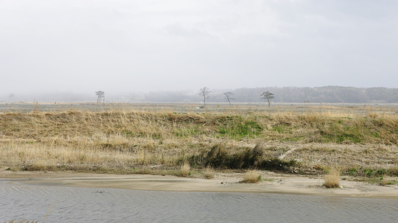
Second only to Chernobyl, the Fukushima Daiichi power plant meltdown is one of the most well-known nuclear disasters of all time. On March 11, 2011, a 9.0 earthquake sent a massive tsunami onto the eastern shores of Honshu Island, eventually resulting in a cooling failure at the plant and a flood of nuclear materials into the region. The evacuation process of the surrounding area was gradual, initially focusing on a 1.2-mile radius before ballooning out to 12 miles. That 12-mile region became the equivalent of Chernobyl's exclusion zone, forcing many to move and find new lodging elsewhere. Many of those areas remain mostly or entirely uninhabited.
The town of Futaba, Fukushima, is a great example of the tragic aftermath of the Fukushima Daiichi meltdown. Futaba had around 7,100 permanent residents before 2011, but the Japanese government enacted an astonishing 11-year evacuation order as the authorities worked to clean up the disaster. In 2022, the order was lifted and the populace was allowed to return. Though many were free to come back, most decided against it, leading Futaba to announce an aspirational goal of bringing 2,000 people into the district by 2030. It could take decades for Futaba and its neighboring areas to return to anything approaching their pre-2011 population numbers.
Thistle, Utah
Thistle, Utah, sits about 67 miles south of Salt Lake City in the Spanish Fork Canyon. It came to be in the late 19th century as a small farming and ranching community at the meeting point of three important railroad lines. Roughly 600 people resided in Thistle by 1917, making use of the area's homes, natural resources, schoolhouses, and saloon. The town's downfall was initially the result of changing market forces that caused trains through Thistle to become less and less frequent over the decades. By the end of the 1970s, almost all of the businesses in town had closed down, but a final killing blow would still hit the remaining 50 or so occupants.
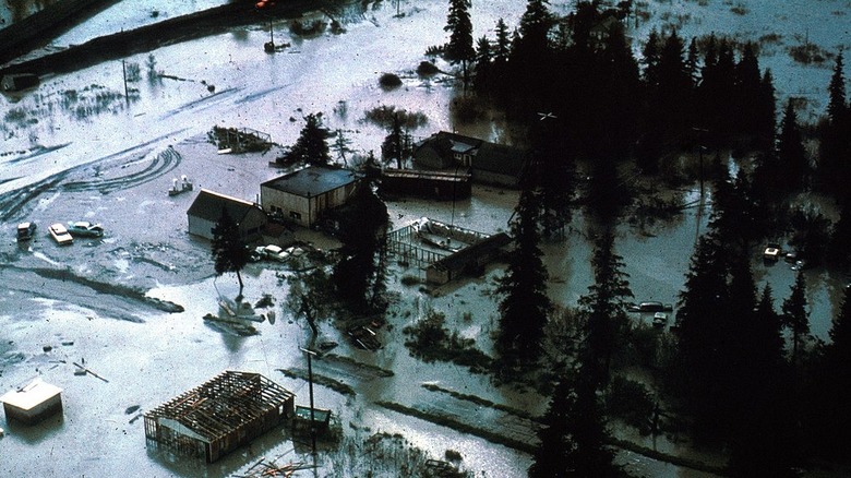
In 1983, a massive landslide sent piles of rocks into two creeks near Thistle. This followed periods of unusually heavy rainfall and late snows, allowing the rocks to form a natural dam and cause a tremendous flood. The town was quickly drowned, reducing almost all of the remaining structures to discarded roofs and half-standing foundations. Most of what used to be Thistle sits unoccupied as abandoned property. In 2018, a lightning storm caused a fire that burned up a considerable amount of Thistle's remaining buildings. Only a few industrial structures and half-submerged houses still exist in the area.
Portage, Alaska
Alaska is a massive, wide-open state with a lot of unused space, but Portage is one of its most unusual locations. Located about 47 miles south of Anchorage, the largest city in the state, Portage didn't have much of a history before its abandonment. The village first pops up on the 1950 U.S. census with an apparent population of 34, which more than doubled by 1960 with a grand total of 71. Unfortunately, Portage didn't make it to 1970 because the Good Friday earthquake of 1964 quickly devastated the small village.
The Good Friday earthquake shattered concrete floors in the area, creating massive cracks in foundations. Water flooded through many of the cracks, both fast-flowing leaks and high spouts. Over the following hours, Portage sank as much as 10 feet, allowing the freezing water to claim all of its structures. The saltwater killed most of the local trees, creating a ghost forest of dead trees that still stand. The few residents immediately realized that rebuilding was not an option, but tourists can visit the wreckage and enjoy the Alaska Wildlife Conservation Center that lies in its wake.
Plymouth, Montserrat
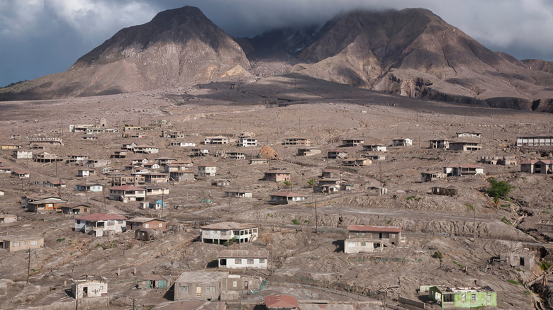
Plymouth, Montserrat, might have one of the biggest falls from grace of any abandoned locale. It's the capital city of the tiny British island territory, and it was once one of the most lavish vacation destinations on Earth. In fact, the northern half of the island is covered in lush jungles and beautiful beaches to this day. Celebrity guests used to enjoy a wide variety of exclusive entertainment options at the high-class Montserrat Springs Hotel, and a nearby recording studio once hosted Paul McCartney and the Rolling Stones. That reputation for tourism faded after a series of devastating volcanic eruptions in the late 1990s.
In 1995, Mt. Soufriere began to emit smoke, drawing a fair amount of attention as the volcano had sat dormant during the previous several centuries. Just over a year later, the mountain erupted, sending a torrent of lava and pyroclastic ash onto nearby villages. In the summer of 1997, a particularly violent burst buried most of Plymouth in mud and ash, ending the tourism economy. A considerable percentage of the south of Montserrat sits in an exclusion zone, which strictly regulates all movement based on volcanic activity in the area at any given time. Some bold explorers still tour Plymouth, taking in the sights of a ruined paradise.
Attu, Alaska
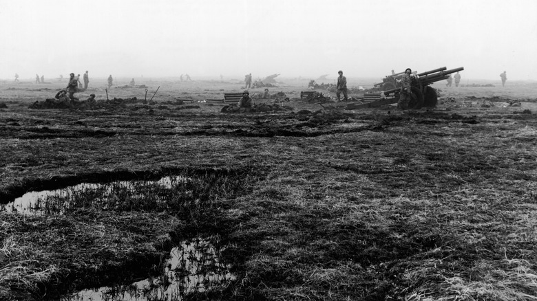
The people of Attu, Alaska, weren't displaced by a natural disaster or a fateful mistake but stolen from their land by an invading army. Attu is the westernmost land mass of the Aleutian Islands off the coast of Alaska. Its Indigenous population were the Aleut people, of whom there were only around 1,000. Their most populous village held less than 300 residents in its heyday. Attu became a tactically important target for American and Japanese forces during World War II, marking it as the first and only land engagement of the war to take place on North American soil. Alaska was still pre-American at the time. Japanese soldiers took Attu without resistance, but when they had to leave the island behind, they took its population with them.
The small population of Attu underwent violence and internment in Japan. The U.S. Army was far from blameless, burning their villages to the ground to prevent the Japanese from using them. When the U.S. returned the Attuans, they relocated them to a radically different region of Alaska, leaving their homes abandoned. The first Indigenous Aleutian people to step on Attu since World War II reached the island in 2017 after a two-day trip aboard a research vessel. The island still lacks facilities to accommodate visits lasting longer than a few hours, but there is still a chance to rebuild.
