Why This National Park Trail In Utah Is So Dangerous For Novice Hikers
Established in 1964 after the campaigning of Superintendent Bates E. Wilson (per National Park Service), Canyonlands National Park is a striking preserve of canyons and mesas centered around the junction of the Colorado and Green Rivers. Cut into four districts by its waters, the Utah park boasts a variety of flora and fauna and showcases millions of years' worth of erosion on the rocky landscape. It's 527 square miles, and low light pollution makes it ideal for stargazing.
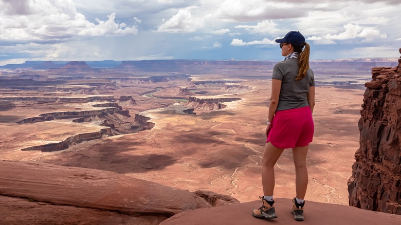
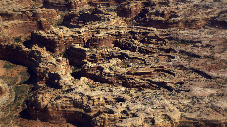
The park's remoteness also makes it a great spot for a nature hike. Canyonlands offers many hiking trails adding up to hundreds of miles. Any interested party can access the trails in two of the districts, the Island in the Sky and the Needles, with relative ease. The trails are rated by difficulty (easy, moderate, and strenuous), and there are several of each. The Maze District, however, has more limited access and demands more of visitors. Stretches of trails are left unmarked, and what markers are in place are cairns. The district is well-named, as hikers can easily get lost. Self-sufficiency is a must.
But for those willing to put in the work, the Maze is a unique experience. The NPS says that most visitors who go there stay for at least three days, and many for over a week. As for hiking, Insiders Utah names the Maze's Overlook Trail the best way to see the district's spectacular canyons. The eight-mile path can take over three hours to walk, but its summit offers views like no other.
You'll be well-warned by park rangers before hiking
The Maze as a whole made it onto Outside Magazine's list of most dangerous hikes for its remote location and navigational challenges but Outside noted that its casualty rate is much lower than the other districts of Canyonlands National Park. Rangers make it a point to inform hikers of the risks and the need to be well-prepared with a solid communication system. The National Parks Service provides maps of both the Maze and the Glen Canyon National Recreation Area, which borders Canyonlands to the west. The NPS also stresses the value of these maps over GPS, which often goes astray in the Maze, and warns of the danger to vehicles on the rugged four-wheel drive roads used to access the Overlook and other trails. Vehicle risk on these roads is arguably stressed over the risk to hikers on the Overlook itself.
There is a ranger station in the Maze, the Hans Flat Station, and rangers are available from 8 a.m. to 2 p.m. for normal services and from 7:30 a.m. to 5 p.m. for emergencies. But no amenities are offered there; hikers need to provide their own resources and equipment. The NPS recommends 25 feet of rope for raising or lowering packed supplies over difficult areas of the Overlook trail and warns any hikers with a fear of heights of what they're in for. Other recommended supplies include those needed for self-rescue in the event of an accident or emergency.
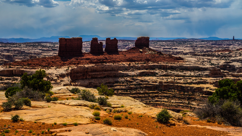
The Maze Outlook provides wonderful sights
Anyone planning to stay overnight or longer in the Maze, or any part of Canyonlands National Park, requires a permit from the National Park Service, and it can be necessary to book up to four months ahead of time for visits during the peak seasons of spring and autumn. If you're willing to do that, to heed all the precautions advised by the NPS, and if you have some basic hiking skills, then the Overlook will not only afford you great views of Canyonlands' namesake formations, but it will take you within sight of some individual features of note.
Because of the border shared with the Glen Canyon National Recreation Area, the Overlook passes by the Orange Cliffs of that park (per Insiders Utah). Within the Maze itself are the Chocolate Drops, a series of mesas with a deep brown color that sets them apart from the rest of the landscapes. The drops have given their name to an easier trail than the Overlook — though, at 8.3 miles, it isn't any shorter, and its estimated completion time is the same. The summit of the Overlook, 964 feet up, provides a panoramic look at the Drops and the whole district.
If the warnings are off-putting but you want to experience the hike, during the spring and summer, rangers do offer guided walks through the district's Horseshoe Canyon. Even this seven-mile trek is considered strenuous though, and hikers are urged to pack plenty of water for the summer heat.